Temperatures in the ACT and surrounds will plummet into Friday as a cold front moves across southern NSW. Photo: File.
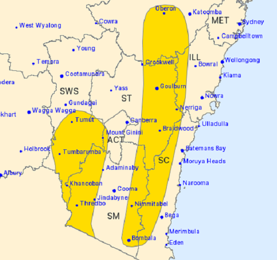
There may be an extreme fire danger warning for the Southern Ranges today (2 February), but a cold snap is about to get us all reaching for thicker jackets a little ahead of schedule.
The warning impacts the Goulburn Mulwaree, Upper Lachlan, Yass Valley and Queanbeyan-Palerang areas, with a total fire ban also in place.
The Bureau of Meteorology’s Morgan Pumpa said this was due to a “dry and windy” change taking place this afternoon.
“There will be fresh and gusty west to north-westerly winds, leading to those elevated fire danger ratings,” she said.
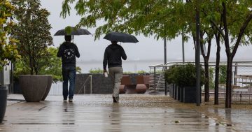
A cold front is sweeping across Victoria and southern NSW, with a damaging winds warning issued for the Snowy Mountains into this evening.
While fire danger ratings will remain high for much of southern NSW tomorrow (3 February) – except for the ACT and Snowy Monaro areas – our maximum temperatures will take a battering.
“Wagga Wagga will be about 7 to 10 degrees below average,” Ms Pumpa said.
“While for Thredbo, its average February maximum is 21 degrees, but it’s expecting a maximum of 3 degrees on Friday so that maximum is actually a few degrees below the average minimum temperature that we’d expect for this time of year.”
There’s also the potential for snow above 1500 metres, with a sheep grazier warning issued for parts of the Southern Tablelands, South West Slopes, Snowy Mountains and the ACT.
Whether the snow stays on the ground will be another story.
“This may be a bit of a shock to the system for people, especially given we had quite high temperatures last Friday, and now this Friday we’ll have quite low temperatures,” Ms Pumpa said.
“There’s still an extreme UV index as well, so even though it will be quite cool, sun protection is still recommended throughout the day.”
Saturday will also be cool, with temperatures predicted to increase again on Sunday.
Original Article published by Claire Fenwicke on Riotact.