Last week I shared with you all in my blog article, Running 145kms around Canberra on the Centenary Trail which is a challenge I have set myself to complete over seven stages. If you missed this article it contains the back story of why I am doing this challenge.
The Centenary Trail is a self-guided trail for walkers and mountain bikers that showcases Canberra and will take you on a journey between urban and rural environments. The trail is designed to be accessible for as many walkers and cyclists as possible. It follows fire trails, walking tracks and shared paths and is open to everyone. You can read up more about the Centenary Trail here and access maps to follow.
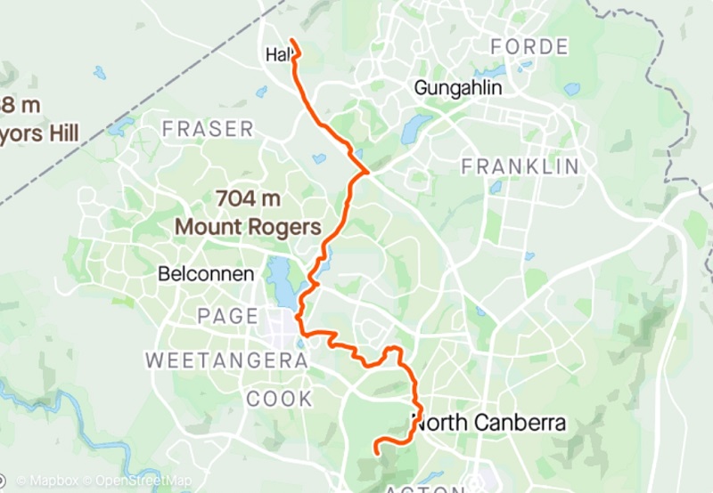
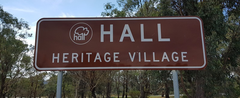
After much deliberation about where to start this challenge I decided to start at Hall and run the trail anti-clockwise to Black Mountain Tower. I also thought it would be nice for the final stage to be running up high looking out over Gungahlin back into Hall.
To prepare for this first stage I looked over the map online to get a good idea of where the trail goes and anticipate what to expect. I also uploaded a map file to my Garmin watch for extra reassurance knowing there is markers out on the trail. This would be the first time I use the course function on my Garmin, so I was kind of counting on it working.
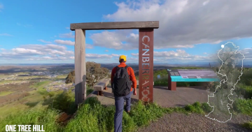
Sunday morning after a little sleep in I got up and had some cereal for breakfast put on my trail shoes and grabbed my hydration vest and set off for Hall. The bottom of the hike up to One Tree Hill was my starting point but I will be heading the other way, away from One Tree Hill. Parking is a little bit sketchy here, but I am pleased to hear that ACT Government is looking into possible off-street parking.
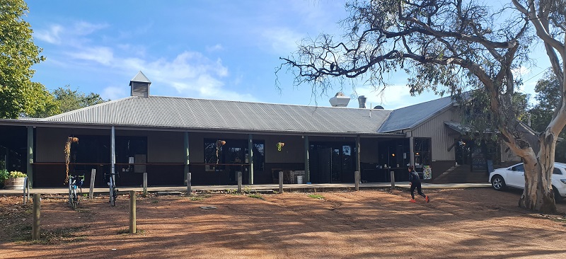
Once I started my course on my Garmin, I was off heading down Hall Street towards the showgrounds, then I turned onto Gladstone Street towards 1882 Bar & Grill. I just twigged it must be called 1882 from when Hall was originally established but back then it was called Ginninderra. It was eventually renamed to Hall in honour of the first landholder in the area, Henry Hall.
Then I was heading along the side of Victoria Street. Did you know that Victoria Street used to be the Barton Highway before the dual carriageway was built?
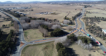
Off Victoria Street I then ran along the side of the Barton Highway up along the ridge to the side of the road. I then crossed over Curran Drive into Gold Creek Village home to some great tourist attractions, cafes and shops. Like Hall there is history to be discovered here as well.
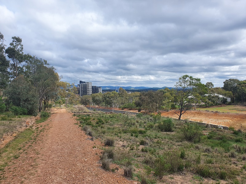
The trail takes you behind the back of the National Dinosaur Museum and then back out onto the Barton Highway under which you loop under to run along side William Slim Drive next to the CSIRO land. Won’t be long before that’s all residential development.
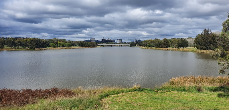
I then crossed under William Slim continuing to run alongside Ginninderra Creek which soon becomes Lake Ginninderra. The path here becomes familiar as it is part of the Ginninderra parkrun course which I have run a couple of times. Unfortunately parkrun which is part of my weekly routine is currently on hold due to the restrictions from COVID-19.
The trail then heads passed John Knight Memorial Park, a playground I had explored a lot when I was a child! The trail then heads based the skate park, up towards CISAC and then up College Street towards University of Canberra. I should point out this was the first time the Centenary trail markers let me down. I wasn’t quite sure when I crossed over College Street from CISAC exactly where to go as there was no markers. I went off my Garmin which said to run up College Street through the bush between the road and the houses.
The next section is through the Gossan Hill Nature Reserve. This reserve contains a significant ochre quarry. Ochre is a highly valued cultural material, and one that has been traditionally used for ceremonies and art. The reserve gets its name from gossan being a Cornish word meaning ‘iron hat’.
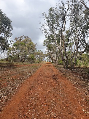
I enjoyed this part of the trail as it was really the first time for this stage where I was on a proper trail and running through bush rather than on a bike path and in an urban area. There were a few turns here and there in the reserve that were not marked that well but roughly knowing which way to go I felt confident. After running through this reserve, I ended up near CIT Bruce campus and ran around the back of it and came out near the athletics running track as the AIS.
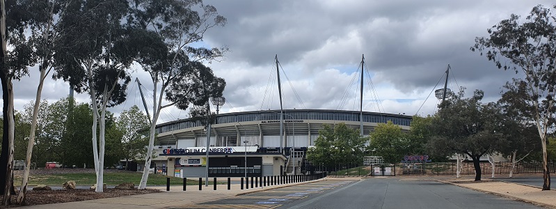
I must admit it did feel a bit surreal running past GIO stadium with no people around. I am not sure what it is normally like on a Sunday morning but being used to the hustle and bustle of a footy game day it was weird no-one around. As I ran through the AIS complex I did end up going the wrong way into a dead end but then I spotted a ramp that took me up towards the playing fields at the back.
I then ran through an underpass under Gungahlin Drive that having driven over it hundreds of times I had no idea it was even there! This takes you through Bruce Ridge Nature Reserve which borders Black Mountain and O’Connor Ridge nature reserves.

It’s not long and I am heading into Black Mountain Nature Reserve and making the steady climb up the mountain to my destination. According to the Centenary Trails map they suggest stopping this particular stage at the bottom of Black Mountain and saving the climb for the next stage. I looked at that and thought no way I want to end on a high and summit Black Mountain! After 100m into the 900m climb I started to regret this decision! After running just over 20 kilometers that last section was slow going. I stopped regularly to catch my breath and take in the views from this side of the mountain I hadn’t seen before.
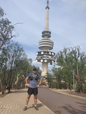
I eventually made my way to the top of the trail and found the Centenary Trail sign to stop my Garmin and mark the 21.3 kilometer end of stage 1 of 7 of my 145km trip on the Centenary Trail.
Overall I was quite happy with the way this stage went with some great surprises along the way of sights. Feel free to check out my video of highlights below.
With each stage I complete I will share with you my adventure and images captured along the way which hopefully encourage you to get out and have your very own adventure.
To support my fundraiser for Pancreatic Cancer UK for my Berlin Marathon 2020 challenge I am holding a raffle and tickets are just $10 each with some great prizes on offer.
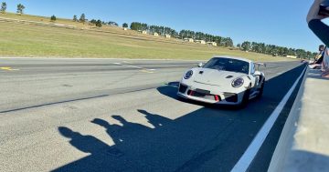
Do you have the need for speed? In this raffle, prizes include driving a V8 race car at Sydney Motorsport Park, reach over 200km/h skydiving over Canberra from 15,000 feet and a B737 Jet Flight Simulator experience.
Buy your tickets here: Need for Speed Raffle
Tickets will be drawn on Friday 12th June 2020 at Gungahlin Eastlake Club.