Altocumulus lenticularis cloud over Gungahlin. Photo: Nida Aslam.
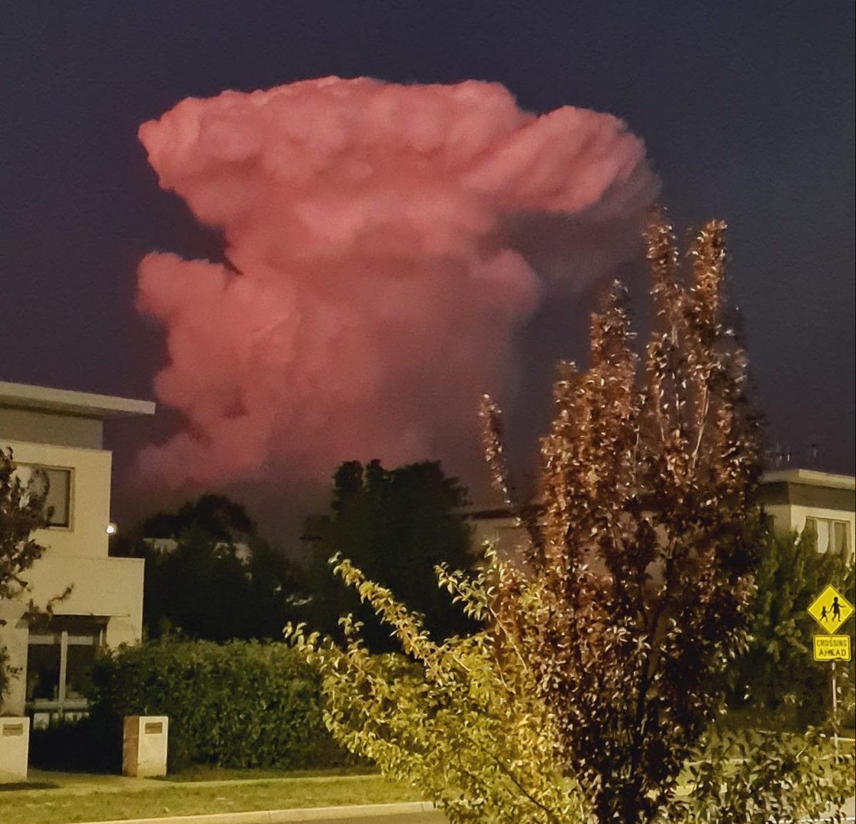
You might have thought it was a marshmallow man, a giant anvil, a man wearing a hat or even a nuclear bomb.
But the rapidly rising cloud in our skies on Monday night was none of these things. What many Canberrans were witnessing was, in fact, an altocumulus thundercloud in the evening skies.
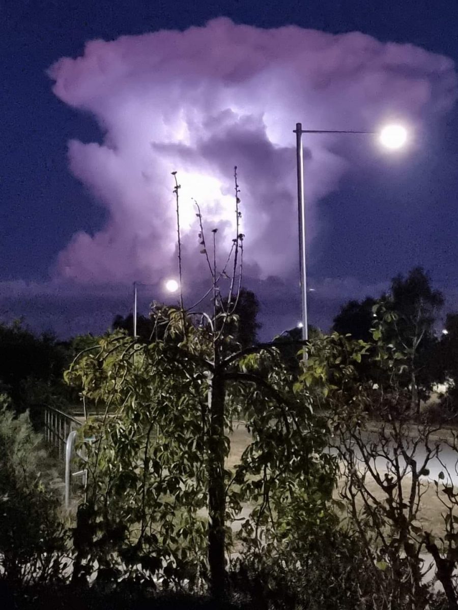
The puffy pink cloud with a spreading top lingered as darkness fell, pulsing lighting bolts from its centre in a striking display over Taylor and Majura.
It was almost certainly what’s classified as an altocumulus thundercloud. The name is a little misleading: the clouds don’t usually produce rain but rather precede it, indicating the likelihood of intense precipitation.
The clouds form high in the air – around 2000 to 6000 metres above ground level, in what’s classified as the mid-altitude levels.
They’re thin and the cumulus element in the name refers to the Latin word for a pile, or heap, from their stacked-up appearance.
Cloud over Gungahlin. Photo: Sue Cadd.
There are several subclassifications, including altocumulus castellanus, altocumulus floccus, altocumulus lenticularis, altocumulus stratiformis and altocumulus volutus, all referring to the different shapes the clouds take.
The lenticularis varieties are stationary clouds (the one seen by Canberrans appeared to be hovering) and their shape is often compared to, and re often comparable in appearance to, a lens or saucer, leading to occasional but inevitable comparisons with flying saucers.
While they generally don’t produce rain, the cloud’s appearance indicates significant atmospheric instability is forming, with a strong likelihood that powerful storms will follow.
They’re formed by convection that reaches the middle troposphere (the lowest level of atmosphere).
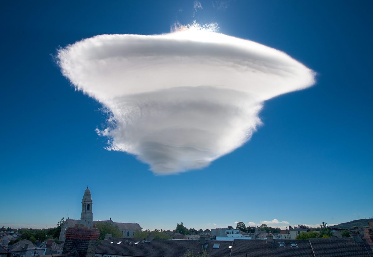
A classic altocumulus lenticularis cloud over Dublin. Photo: Wikipedia commons, Omnisource5.
The earliest aviators were adept at identifying cloud formations and knew the altocumulus as a sign of potential danger ahead for their light craft. Today, aviators still use them as an indicator of risk, particularly where there’s a possibility of icing up when flying through these formations.
Extensive altocumulus formations, particularly if they take the form of undulatus, are often referred to as altocumulus mackerel sky – the dappled skies that can sometimes stretch for hundreds or even thousands of kilometres.
The other classic warning clouds are towering cumulus and cumulonimbus.
However, while airplane pilots avoid the clouds because of their internal turbulence, glider pilots actively seek them out as they can harness the rising air mass at the edge, which is smooth, strong and enables their craft to reach remarkable heights.
Original Article published by Genevieve Jacobs on Riotact.