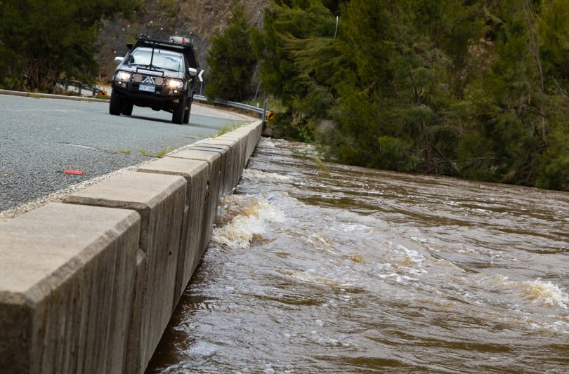
Water levels rising at Uriarra Crossing on Monday (15 November). Photo: Michelle Kroll.
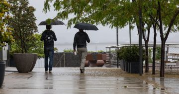
The wet is set to continue, with another big weekend of rain and growing flood concerns for the ACT and the surrounding region.
The ACT is forecast to receive up to 4 mm on Friday, between 10 and 20 mm on Saturday, and between 25 and 40 mm of rain on Sunday, along with the chance of thunderstorms.
The mean monthly rainfall total at Canberra Airport for November is 66 mm, and the wettest November since the new recording system was introduced in 2008 is 119 mm. As of yesterday, 105 mm has fallen so far in November.
The region’s current high humidity will interact with the trough over central parts of Australia and likely form a low-pressure system in NSW and the ACT bringing rain and possible thunderstorms.
Forecaster at the Bureau of Meteorology Gabrielle Woodhouse explained that the interaction of both systems is making it challenging to estimate rainfall totals.
“It is going to be a little bit varied based on what kind of showers and storms we do end up seeing, but it looks as though there is a reasonable likelihood of picking up another 20 or 25 mm and potentially a fair bit more,” said Ms Woodhouse.
“The higher totals are going to be dependant on some of the thunderstorms as well, so we are looking at another wet period for Canberra and the ACT,” she said.
The primary concern is that with many of the region’s rivers delicately positioned due to last week’s rain, intense rainfall could lead to rivers flooding quickly. Ms Woodhouse mentioned the Western Slopes as a particular concern for the BOM, especially the Lachlan River near Forbes. The ACT will also be on high alert with flood watches and flood warnings possible.
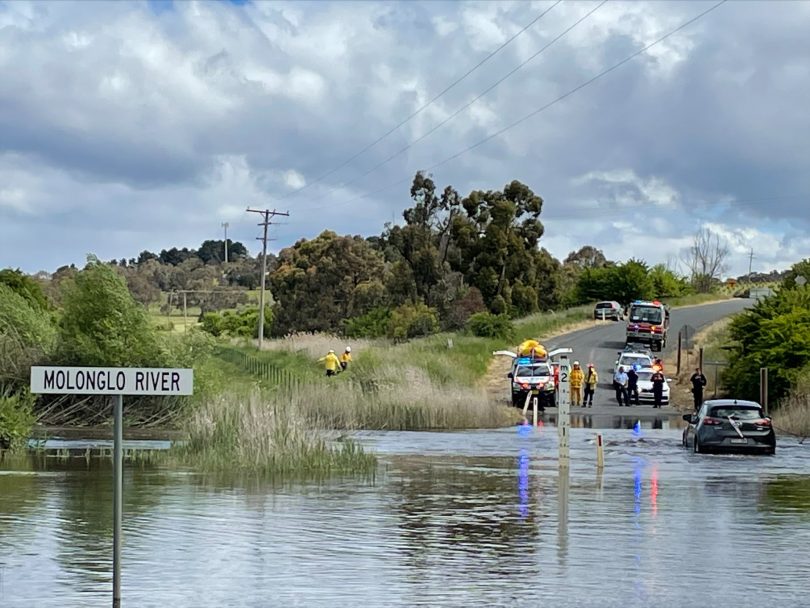
A rescue at the Molonglo River Causeway on Briars Sharrow Road. Photo: Queanbeyan SES.
Moderate east or southeasterly winds are expected, depending on the low-pressure system.
“There could be a little bit from the east, there could be a little bit from the west, it’s just going to depend on just how that low decides to behave on the weekend. It seems as though we’ll start to see more southerly winds once we get to Monday,” said Ms Woodhouse.
She expects no reprieve from the rain during summer, with more wet months ahead and La Niña still a possibility.
“At the moment, we do have some fairly warm oceans, and that’s helping to generate the humidity and the rainfall,” she said.
“We are still looking at around a 30 per cent chance of a La Niña forming for this coming summer and they usually last several months and start to decay towards the end of summer.”
Showers are expected to steady on Monday before clearing with a sunny Tuesday with a maximum of 24 degrees.
Original Article published by Max O’Driscoll on Riotact.